Discover Jefferson
39 carefully curated photography spots with GPS coordinates, shooting tips, and local insights
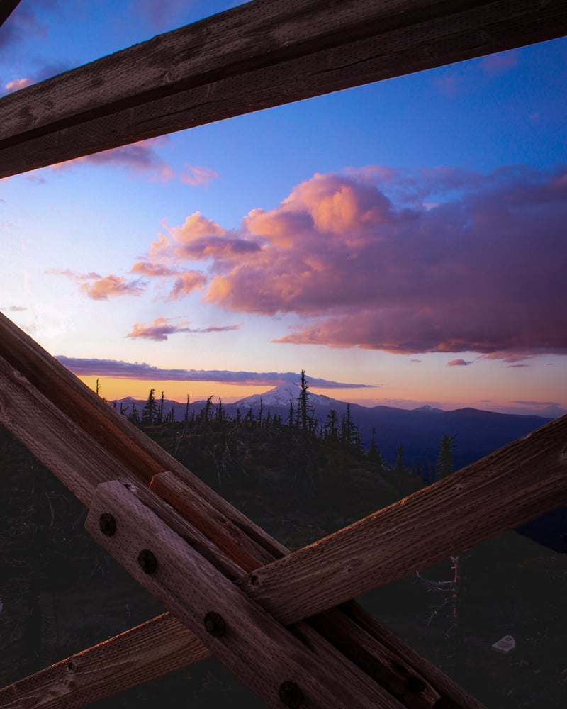
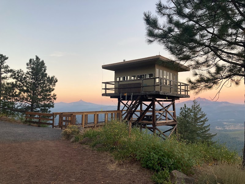
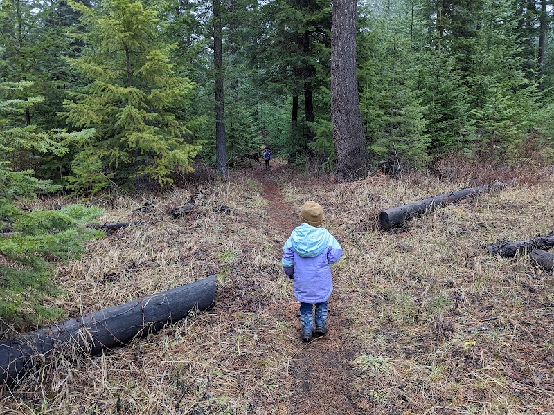
Black Butte Fire Lookout
The summit of Black Butte offers sweeping panoramic views of the Oregon Cascades. The historic fire lookout structures provide excellent foreground elements to naturally frame distant peaks like Mt. Jefferson. It is an exceptional location for capturing dramatic sunrise and sunset colors over the surrounding national forest.
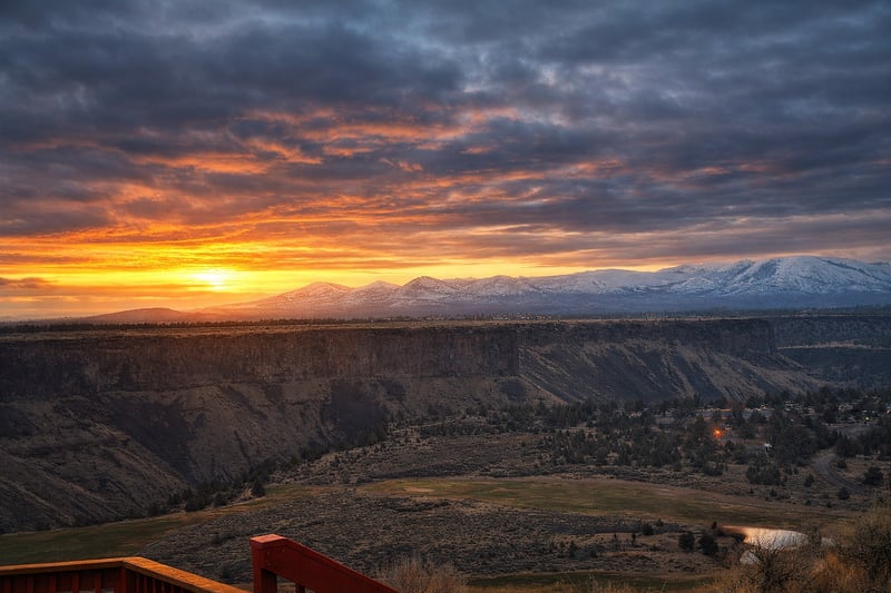
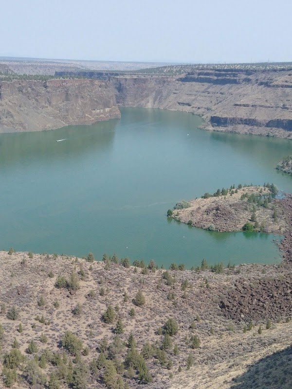
Crooked River Gorge Outlook
This overlook offers a dramatic view of the Crooked River Gorge with the Cascade Range in the distance. It is a premier spot for capturing high-desert sunsets and the scale of Oregon's volcanic landscape.
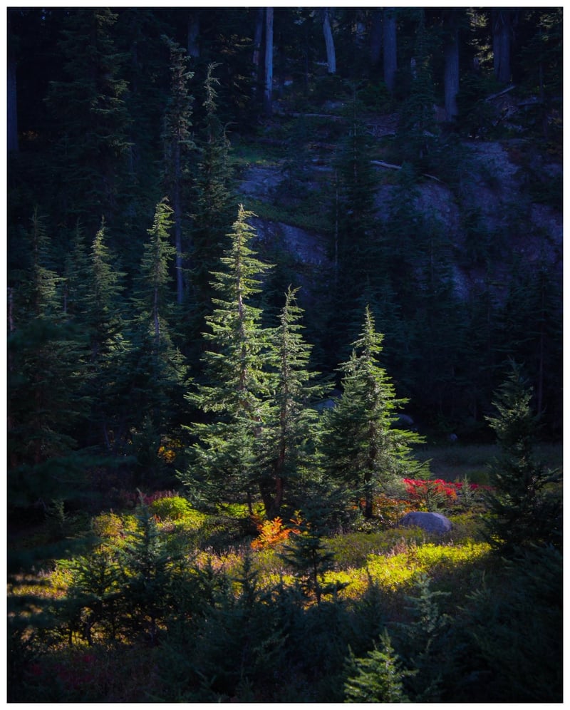
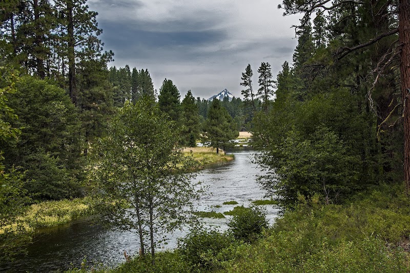
Camp Sherman Forest Clearing
Located in the Metolius Basin, this area offers dense evergreen forests with vibrant undergrowth. The location is famous for its 'spotlight' lighting effects where the sun breaks through the thick canopy to illuminate specific patches of the forest floor, especially during the autumn transition.
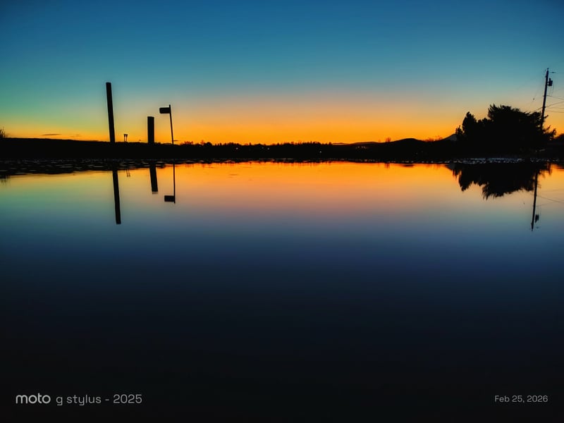
Madras Sunset Reflection Pond
This location in Central Oregon provides a perfect mirror surface for capturing the vibrant colors of the high desert sky. The flat horizon and minimal obstructions allow for clean, symmetrical compositions during the transition from golden hour to twilight.
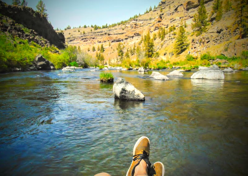
Steelhead Falls, Deschutes River
A rugged canyon landscape along the Deschutes River, known for its dramatic basalt cliffs and the powerful Steelhead Falls. The area provides excellent foreground interest with river rocks and clear water against the high desert backdrop.
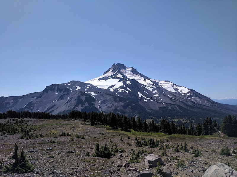
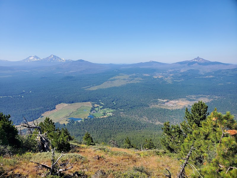
Mount Jefferson
Mount Jefferson is a dramatic glacial-striated stratovolcano rising above alpine meadows and tarns in the Mount Jefferson Wilderness. Photographers shoot sweeping mountain portraits, reflected peak shots in high-elevation lakes, wildflower carpets in summer and stark snow/ice textures in shoulder seasons. Access requires hiking on maintained trails (day hikes to Jefferson Park are popular); high elevation means snow can linger into summer — check Forest Service trail conditions. Parking at trail
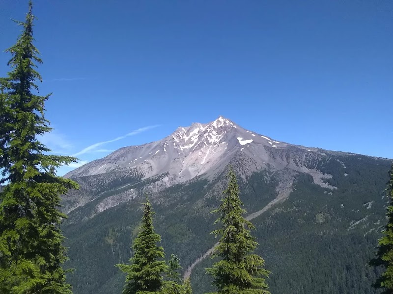
Mount Jefferson Wilderness
Alpine volcanic peaks, jagged ridgelines and snowfields around Mount Jefferson with mirror-like mountain lakes (Jefferson Park, Santiam Lake), expansive wildflower meadows and glacial cirques. Best visited late June–September for wildflowers and clear skies; autumn offers crisp light and larch color. Sunrises cast warm light on the north face; sunsets light the western ridges. Access via Santiam Pass trailheads; primitive parking at trailheads, limited cell service, no formal entrance fee but be
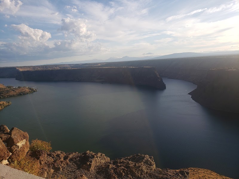
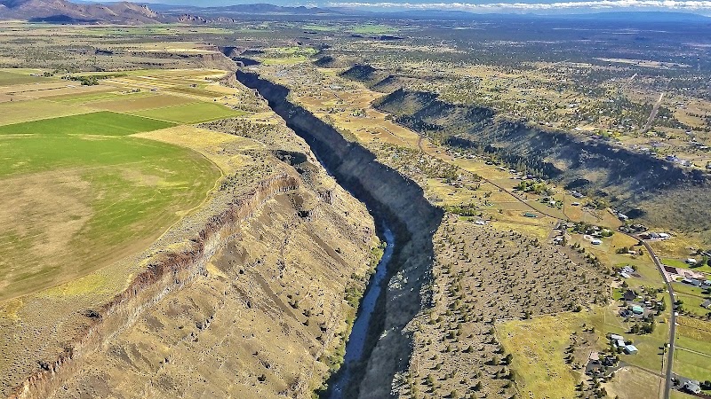
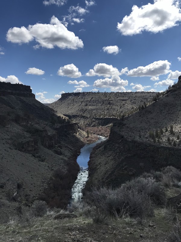
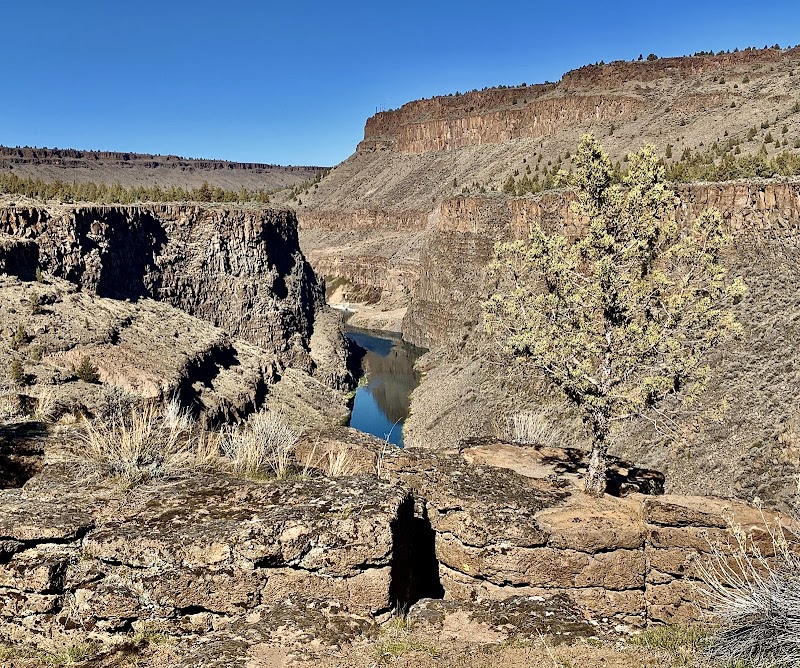
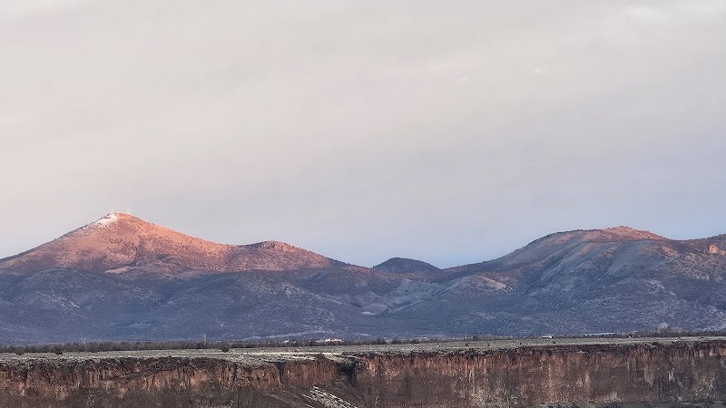
Crooked River Gorge
Dramatic basalt walls dropping to the sinuous Crooked River and the iconic Crooked River High Bridge offer layered textures, warm cliffs and sweeping compositions. Accessible viewpoints and small highway pullouts make short-walk shooting easy. Best at golden hour (sunrise or sunset) for warm side-lighting and long shadows; weekdays and early mornings avoid tour groups. No formal entry fee; park safely in designated lots and respect railings. Seasonal contrast: spring runoff and autumn colors add
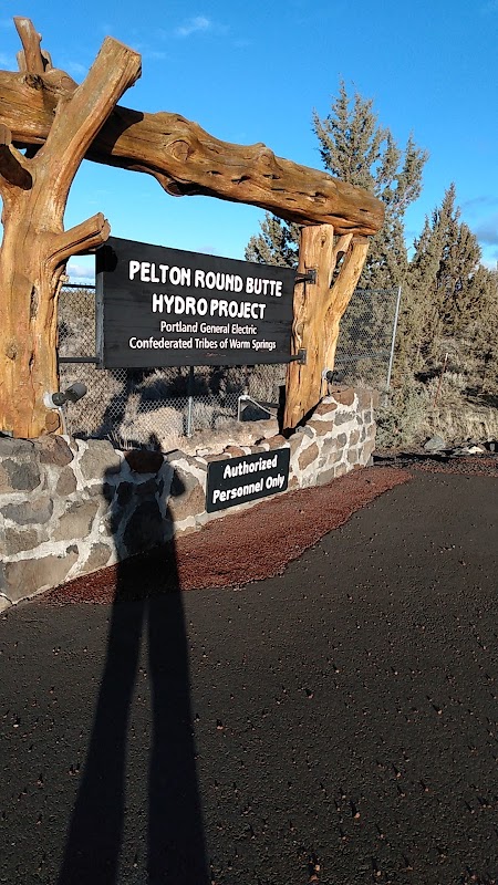
Dam Observatory
Overlooks a large concrete dam and the dramatic canyoned reservoir — strong geometry, textured concrete, turbulent spillway water and sweeping waterline cliffs. Best at golden hour and blue hour when warm light softens canyon walls and long exposures smooth water. Easily reached by car with a small parking area; bring layers (wind off the reservoir), and respect safety barriers. Flow rates vary by season—spring release can add drama; summer offers calmer, clearer reflections.
Pelton Wildlife Overlook
Small roadside overlook above the Pelton Reservoir and river corridor offering panoramic views of wetlands, migrating waterfowl, raptors and high-desert landscapes. Best at dawn or dusk for golden hour and active birds; spring and fall migration peak seasons. Easy roadside parking, no fees; accessible from NW Vanora Dr. Summer is hot; bring layers and binoculars. Quiet, uncrowded — ideal for wildlife and waterscape frames.
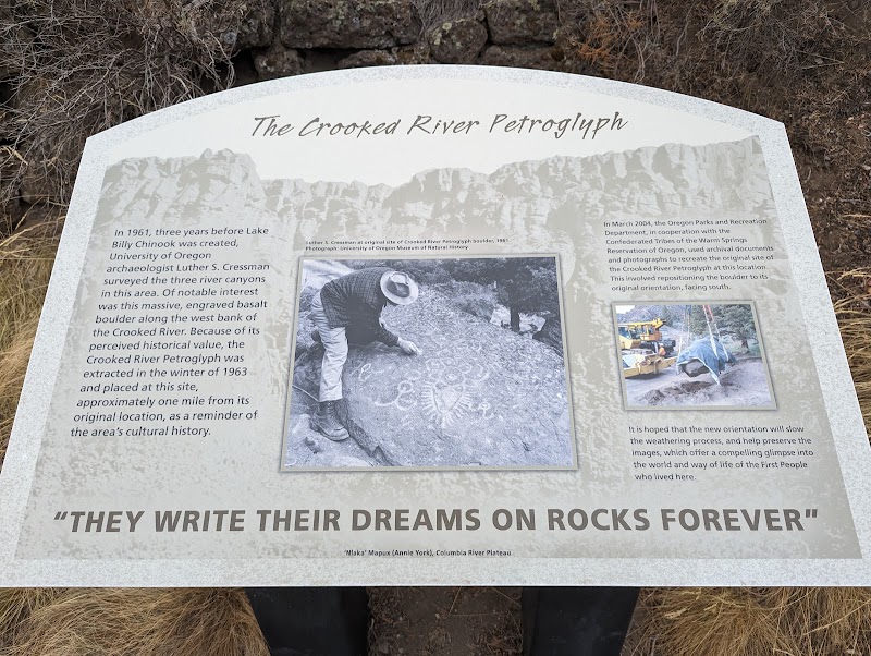
Petroglyph Site
Small roadside petroglyph site on a basalt outcrop near Culver — high-contrast carved rock panels and surrounding sage/Juniper landscape. Photograph ancient Indigenous motifs, textured stone surfaces, and wide landscape context. Best at low sun (early morning or late afternoon) for raking light that reveals carved relief; overcast days bring even tones for detail. Accessible via a short trail from a small pullout parking area; bring water and respect cultural restrictions (do not touch or climb;
アキラクリフ AKIRA CLIFF
Steep basalt cliffs overlooking the Deschutes River canyon offering dramatic rim viewpoints, layered rock textures and sweeping river curves. Best at golden hour for warm side-light on the cliff faces and at sunset for silhouette/rimlight. Accessible from SW Pearl Rd; parking is informal (pullouts), trail access may be unmarked and rugged—expect short hikes over uneven ground. No entry fee; check local landowner/BLM access and seasonal closures. Weekdays and shoulder seasons have fewer visitors;
Crooked River Ranch
Crooked River Ranch sits along the dramatic Crooked River canyon with rimrock cliffs, winding river channels, scattered juniper and sage, and wide open skies — ideal for canyon landscapes, waterscapes, raptor and shoreline wildlife, and golden-hour panoramas. Best at sunrise and sunset for warm side-light on cliffs; spring brings wildflowers and higher water flow; late summer offers clear skies. Access is via rural roads with informal parking at boat launches and overlooks; respect private homes
Green Ridge Lookout
Green Ridge Lookout delivers sweeping views over the Metolius River canyon and dense Ponderosa and mixed-conifer forests — ideal for wide panoramas, seasonal color, and intimate foregrounds of ridgeline flora. Best at golden hour (sunrise or sunset) for warm directional light. Access is via a short forest road/trail from Camp Sherman; seasonal snow can close access in winter. Parking at a small pullout; no fees. Expect few crowds on weekdays; pack insect repellent in summer.
UPPER Deschutes Day Use Area
Small day-use park on the Upper Deschutes River offering intimate river scenes, reed-lined banks, basalt outcrops and riparian trees. Ideal for reflections, long exposures of flowing water and candid shots of anglers or kayakers. Best at sunrise/sunset for warm side-light and glassy reflections; spring brings higher flows and lush greens, fall adds color. Easily accessible by car from Culver with a small parking area and short walks; expect limited facilities and seasonal crowds on weekends.
Crooked River Ranch Golf Course
Manicured fairways, ponds and stands of juniper with the Cascade foothills as a backdrop make Crooked River Ranch Golf Course ideal for sweeping landscape shots and reflective waterscapes. Best at golden hour and sunrise for warm light and low shadows; weekdays and early mornings are least crowded. Easy roadside access and parking near the clubhouse; check with course staff for permission to shoot during events or on greens. Weather is dry most summer mornings; spring brings wildflowers and more
Rex T. Barber Veteran Memorial Bridge
A dramatic highway span over the Crooked River/Deschutes canyon offering sweeping views of basalt cliffs, river bends and nearby Smith Rock. Best at sunrise or golden hour when canyon walls glow; clear nights work for star trails. Accessible from US‑97 with roadside pullouts and a pedestrian sidewalk—no entry fee. Weekdays have fewer cars; expect wind in spring. Bring layers and water; short walks from parking give multiple vantage points.
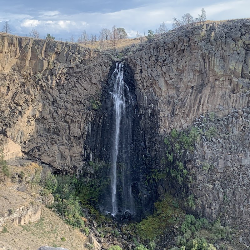
Billy Chinook Falls
Small, scenic falls on the Deschutes River with basalt formations and river pools — great for intimate waterscape and landscape shots. Best visited at sunrise or late afternoon for soft side lighting; spring runoff produces the most dramatic flow, while summer yields calmer reflections. Access requires a short hike from a nearby trailhead with limited parking and no major facilities; wear sturdy shoes. Respect local tribal history (named for Chief Billy Chinook) and Leave No Trace.
Black Butte Upper Trailhead
Black Butte Upper Trailhead is the gateway to a steep hike up a solitary volcanic cinder cone with sweeping Cascade views. Photograph jagged lava rock, alpine meadows of wildflowers (late spring–summer), dramatic ridgelines and wide panoramas at sunrise or sunset. Clear nights offer dark-sky astrophotography of the Milky Way. Trail is exposed and steep; parking is limited at the small lot off Forest Service roads. No permit for day hiking, but expect variable mountain weather and bring layers, 4
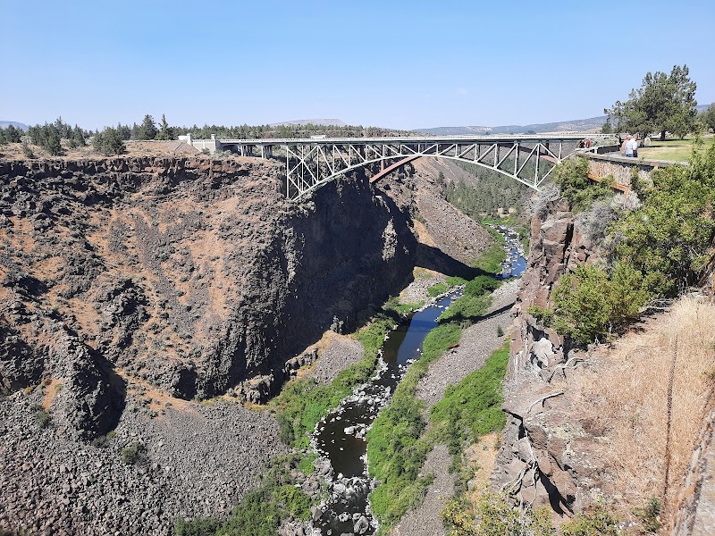
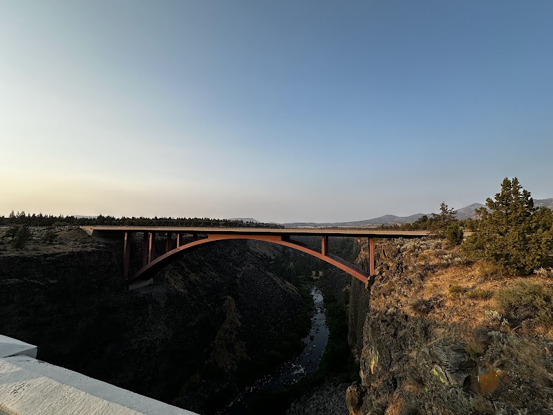
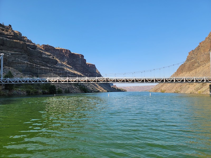
Crooked River High Bridge
Steel-arch Crooked River High Bridge spans a deep volcanic canyon — dramatic lines, repeating trusses and the sinuous river below create strong foreground/background contrast. Easy roadside pullouts and a small parking area on US‑97 give quick access to rim viewpoints; no entry fee but stay behind railings. Best at golden hour for warm side-lighting and long shadows; spring and autumn add color and calmer winds. Check local regulations before flying drones.
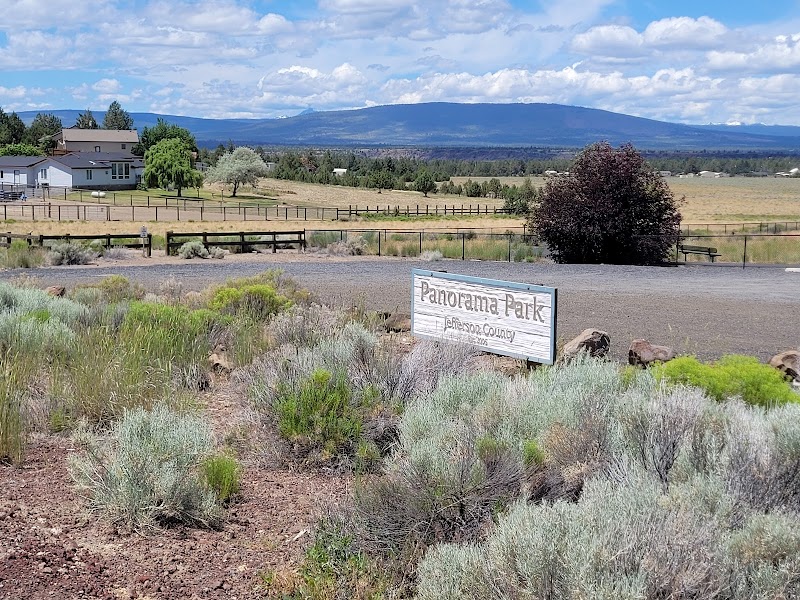
Panorama County Park
Panorama County Park overlooks the Crooked River Gorge offering dramatic basalt cliffs, winding river below and wide sky — ideal for sweeping landscapes, geological detail and raptor activity. Best at sunrise or sunset for warm side-light on the canyon walls; spring brings wildflowers, fall cooler light. Small parking area and short rim trails provide easy access; no special permits, but watch winds and stay behind railings. Weekday mornings are quieter.
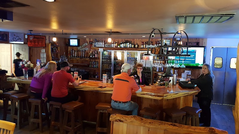
Sandbagger Saloon
A rustic riverside bar with weathered wood, neon signage and a relaxed Central Oregon vibe—great for moody interior portraits, textured detail shots and sunset compositions that include the Deschutes River nearby. Best at golden hour for warm exterior light and at blue hour/evening for dramatic neon and low‑light interiors. Easy roadside access and on‑site parking; casual entry but be respectful of patrons and ask before photographing people. Weeknights and early evenings are quieter.
Otter Bench Trailhead
Trailhead for Otter Bench Trail overlooking the Deschutes River canyon — dramatic basalt cliffs, river meanders, juniper pines and high-desert scrub. Great for layered canyon landscapes, riverscapes and intimate nature details. Best at sunrise or sunset for warm side-light and long shadows; spring brings wildflowers, fall offers crisp skies. Trailhead off SW Horny Hollow has parking (primitive lot); trail is moderate dirt — wear hiking shoes and carry water. Crowds are light on weekdays; check季雪
Head Of The Metolius Observation Site
Perched above the Metolius River canyon, this observation site offers dramatic viewpoints of rugged forest, spring-fed river color, and sky drama over Central Oregon. Best in early morning or late afternoon for low-angle light and softer contrast; weekdays usually feel quieter. Accessible roadside pull-outs; no entry fees, but paved parking can be limited—arrive early. Bring layers; weather changes fast in the Cascades.
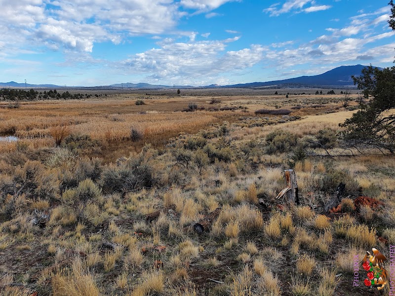
Rimrock Springs Wildlife Management Area
Freshwater springs and marshland attracting waterfowl, shorebirds and seasonal migrants with mirror-like pools and reed-lined channels. Shoot sunrise/sunset for warm sidelighting and reflections; peak bird activity is dawn and dusk, spring/fall migration best for diversity. Accessible from US‑26 with small parking areas—check Oregon WMA rules (seasonal restrictions/hunting). Stay on trails/observation points to avoid disturbance.
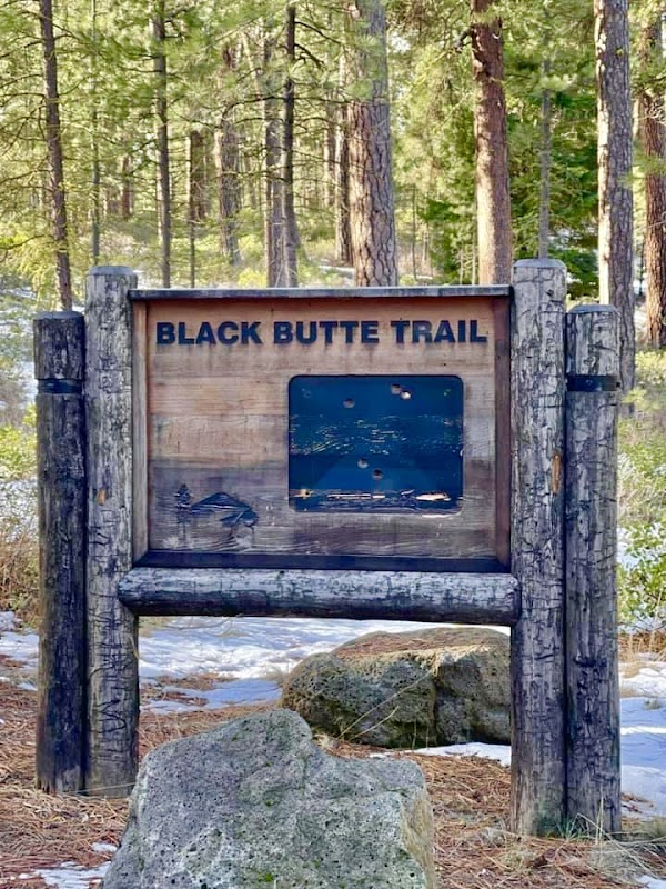
Black Butte Lower Trailhead (For volcano)
Black Butte Lower Trailhead near Camp Sherman is a gateway to views of Central Oregon’s volcanic landscape. Photograph the trail entrance framing the butte, wildflower-studded slopes in summer, and moody clouds rolling across the volcano backdrop. Arrive early for low, directional light and calmer skies.
Wizard Falls
Wizard Falls on the Metolius River offers short cascades through columnar basalt and clear emerald pools — great for flowing-water studies, textured rock close-ups and tranquil river landscapes. Easy, family-friendly access from a small trail/boardwalk near Camp Sherman; free parking at the hatchery/trailhead. Best in spring/early summer for higher flow, fall for foliage; overcast or golden hour light softens highlights and reveals color.
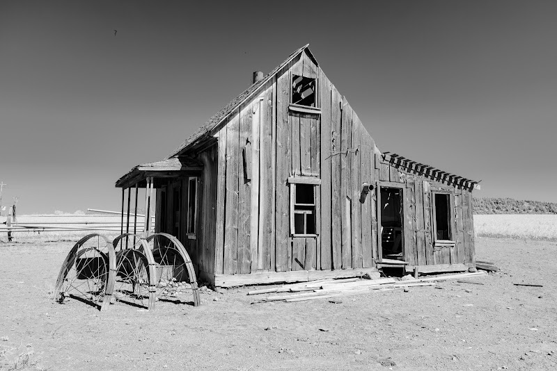
Jericho Lane Farmhouse
A classic rural Oregon farmhouse set against open fields and distant Cascade foothills—great for pastoral compositions, seasonal colors (spring wildflowers, autumn tones) and intimate architectural details. Best at golden hour (sunrise or sunset) for warm side-light and long shadows. Location appears on private farmland—seek owner permission before trespassing. Roadside pull-offs allow framing from fields; bring layers (variable high-desert weather) and expect limited facilities and parking on a
SW Jordan Bridge
A low, rural bridge over the Deschutes River with strong river reflections, rocky banks and cottonwood-lined shores—ideal for intimate waterscape and landscape photos. Visit at sunrise or golden hour for warm side lighting on cliffs and mist over the river; evenings produce dramatic colors. Parking is roadside and limited; expect a short uneven walk down to river viewpoints. No permits for casual shooting, but respect private property and anglers. Weather is seasonal: spring runoff raises water/
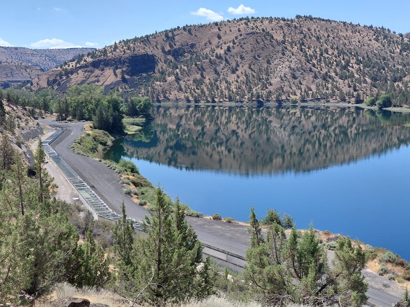
Round Butte Dam
Massive concrete dam set against volcanic canyon walls and Lake Billy Chinook — shoot wide panoramas of the structure and reservoir, intimate details of spillways and textures, and reflections from the water. Best at sunrise/sunset for warm light and long shadows; late spring–early summer offers higher flows and lush canyon colors, fall gives warm tones. Accessible from roadside viewpoints and small parking areas; some overlooks are a short walk from parking. No special permits for casual photo
Black sands
Black Sands (off Sisters/OR) is a volcanic, salt-and-lava-textured shoreline where dark sand contrasts with moving surf and moody clouds. It’s especially photogenic after weather changes when wave patterns sharpen. Expect variable tides, cool coastal wind, and quick light shifts—bring layers and weather protection.
New Highway Bridge Interpretive Panel
Small roadside interpretive panel beside the New Highway Bridge offers close-up graphic detail and context shots plus nearby bridge and river views. Photograph the panel as part of a wider composition including bridge lines, river, and surrounding Ponderosa/steppe. Best light: early morning or late afternoon for warm side lighting and reduced glare on water. Easy pullout parking; short roadside access—wheelchair access may vary. No entry fee. Weekdays have fewer visitors; watch for traffic on US
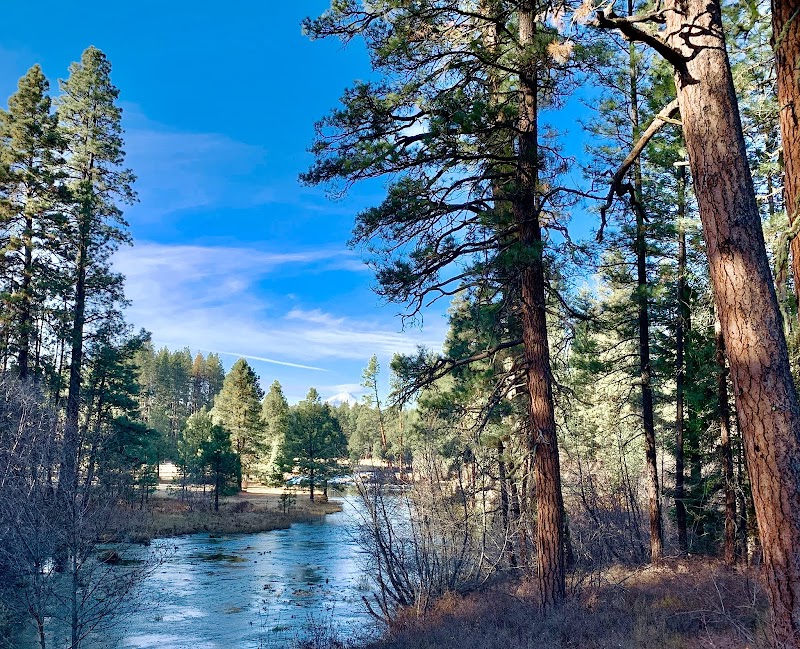
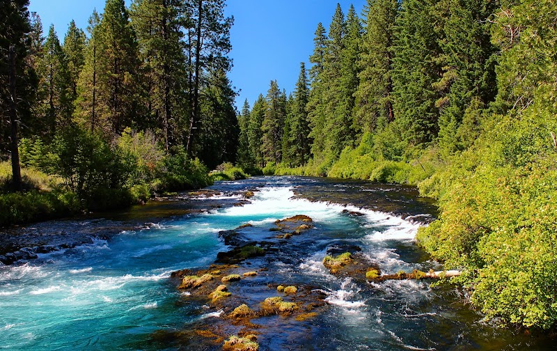
Metolius River
The Metolius River winds through pine-dotted canyons near Culver, offering calm bends, riffles, and reflections. Photograph misty mornings, layered banks, and long-exposure water with the distant rim of the Cascades. Great for landscape and waterscape work with low entry friction—arrive early for softer light and fewer people.
Opal Springs Hydro Dam
Opal Springs Hydro Dam is a quiet, scenic spot where engineered concrete meets moving water and forested hills. Photographers can capture dam structure lines, spillway motion, and misty cascades in soft natural light; access is typically simple by roadside pull-offs, making it ideal for fast, low-crowd stops. Best light: early morning and late afternoon; overcast days boost waterfall-like textures.
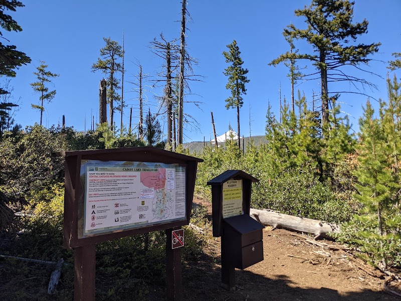
Cabot Lake Trailhead
Cabot Lake Trailhead leads to a small alpine lake framed by conifers, rugged ridgelines and seasonal wildflowers — ideal for reflective lakescapes, intimate forest compositions and mountain panoramas. Best at sunrise or golden hour for warm light and glassy reflections; late spring–early fall offers easiest access (snow often blocks the road in winter). Trailhead parking is limited; no fee but check Forest Service alerts for closures. Expect mosquitoes in summer and variable weather in shoulder季
Hill Road Viewpoint
Roadside viewpoint above the Crooked River gorge near Terrebonne offering sweeping panoramas of the canyon, river meanders and distant cliffs (Smith Rock area visible on clear days). Easy pullout access off SW Hill Rd with informal parking; no fees. Best at golden hour — sunrise brings soft east light in canyon, sunsets add warm backlight and rim glow. Spring and fall offer clearer air and richer colors; midges/wind can affect comfort. Short walk from parking to multiple vantage points; bring a
Metolius Preserve North Hiking Parking
This North Hiking Parking area is a practical starting point for Metolius Preserve trails, with quick access to blue-sky ponderosa backdrops, volcanic rock textures, and occasional glimpses of the Metolius River canyon light. Best in early morning or late afternoon for softer shadows and less glare; expect variable weather and bring traction in wet seasons. Parking is for hikers/trail access; go early on weekends for space.
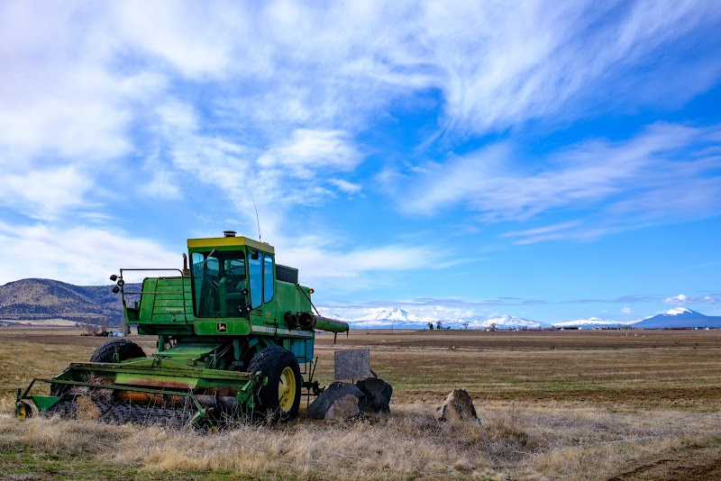
Culver Tractor
A roadside collection of vintage tractors, farm equipment and rustic signage offering classic Americana frames against central Oregon plains. Shoot close textures, weathered paint and silhouette profiles at sunrise/sunset. Site is roadside with informal parking; ask staff permission before detailed shoots. Best light: golden hour and soft overcast for color and detail. Weekdays quieter; wind can affect composition.
Smith Rock Resort
Smith Rock Resort sits at the gateway to Smith Rock State Park — dramatic volcanic cliffs, meandering Crooked River, and constant climbing activity create striking compositions. Best at sunrise and sunset for warm side-light on the red rock; spring and fall offer milder temperatures and colorful foliage. Accessible by car with parking near the resort and trailheads; park day-use fees apply. Weekdays are quieter. Respect climbers and stay on marked trails; lodging at the resort allows pre-dawn or