Geodätischer Referenzpunkt Erding — photo spot in Kronthaler Weiher, 85435 Erding, Germany

G
Geodätischer Referenzpunkt Erding
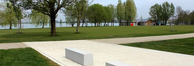
A small geodetic reference marker on the edge of Kronthaler Weiher offering minimalist foreground interest against calm water and treeline. Best at golden hour and blue hour for soft light and mirror reflections; early mornings and weekdays are quiet. Easy access from nearby parking in Erding; flat paths make gear transport simple. No entry fee; respect marker as scientific monument. Especially good for compositions that pair manmade precision with natural symmetry.
LANDSCAPEWATERSCAPEHISTORICAL
G
Geodätischer Referenzpunkt Erding
A small geodetic reference marker on the edge of Kronthaler Weiher offering minimalist foreground interest against calm water and treeline. Best at golden hour and blue hour for soft light and mirror reflections; early mornings and weekdays are quiet. Easy access from nearby parking in Erding; flat paths make gear transport simple. No entry fee; respect marker as scientific monument. Especially good for compositions that pair manmade precision with natural symmetry.
LANDSCAPEWATERSCAPEHISTORICAL